
FEGIS – Federal (National) GIS
Project Name: FEGIS – Federal (National) GIS
Client: Office of the Surveyor General of the Federation (OSGOF)
Country: Nigeria
Objectives
FEGIS project included the design, development and supply of a Federal (National) Geographic Information System (GIS). The system focuses on the cadastral aspect with its sub layers (Orthophoto, photogrammetric layers, contour lines, etc.) and incorporates seamless integration with the Federal Lands Information System (FELIS).
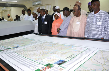
The project highlight was the supply and installation of a large format printer that is used for printing official federal maps generated from FEGIS system. The printer, which is the largest in all of West Africa, is operated by the Office of the Surveyor General of Nigeria in Abuja.
 OSGOF Federal Maps Printing Machine
Sivan Design was responsible for developing and implementing the system and is now responsible for developing more functionality while maintenance and support for the existing system continues.
Background
Following the successful implementation of FELIS (Federal Land Information System) in the land department, an outer-offices committee recommended that the Office of the Surveyor General of the Federation (OSGOF) will develop its own Federal GIS system, focusing on the creation of a cadastral layer for the federal government properties.
The OSGOF, being an independent unit, published a tender for the project in the beginning of 2009. The project was awarded to Sivan Design.
General description
Federal GIS is a geographic system designed to serve the daily activity of the Office of the Surveyor General of the Federation (OSGOF). The system hosts the Surveyor General Geo-Spatial information including both Vector and Raster data. The first phase objectives were to provide the system with the ability to capture and manage cadastral layer and its sub-layers.
Federal GIS have no less than 100 simultaneous connection points it (it is the main portal for GIS data of the OSGOF – ~1,400 employees) and availability for users to work with object-relational databases as well as raster and vector graphics, including orthophotos and digital terrain models (DTM).
The system is created as both centralized and distributed system.
The project enables OSGOF to create on demand maps of any part of Nigeria (Rural and Urban) , with any required layers (borders, states, towns, rivers, lakes, roads, houses, public buildings such as: education, health, religious, etc.) , with any required scales and print it on demand.
Detailed description
The project consisted of the following main task:
- Design, development and supply of a GIS at a national level (926,000 Sq/Km)
- Design, configuration and supply of the Geo-Spatial database including cartographic work, symbology, layers metadata etc.
- Design the system so it can host the entire Geo-spatial data of the client – vector data and raster data. On the raster aspect, the system was designed to manage and control the mass aerial and satellite imageries been captured and Ortho-rectified by the OSGOF each year
- Support both Web-access users (web GIS application) and Clients desktop users. The system supports all the employees of the OSGOF (~1,400) whereas 10% should be able to use the system concurrent
- Enabling designated Cadastral Geo-Spatial procedures (union and division), queries, editing and topology.
- Storage and retrieval of mass Ortho-photo (raster data) data. Storage of the raster data meta-data.
Today uploading of information to the system is functional, and more plots are uploaded every day. The system was developed and implemented by Sivan Design using the most advanced technologies and infrastructure.
The office for Cadastral GIS
Federal (National) GIS at the Office of the Surveyor General of the Federation
Federal GIS is a turnkey project including software, hardware, communication and infrastructure responsibilities, it focuses on Geospatial capabilities and require deep knowledge in Plot registry, GIS technology and cadastre rules.