
FIGIS – FCDA Underground Infrastructure Geographic Information System
Project Name: FIGIS – FCDA Underground Infrastructure Geographic Information System
Client: Federal Capital Development Authority, FCDA
Country: Nigeria
Website: www.figis-ng.com
The Federal Capital Development Authority (FCDA) is part of the Federal Capital Territory Administration (FCTA) located in Abuja Nigeria. The goal of FIGIS is to record geospatially referenced geographic information of all the Underground Infrastructures of the Federal Capital Territory of Nigeria.
The FIGIS supports a wide scope of infrastructure information gathered from several sources including:
- Electricity infrastructure
- Water Supply Pipe Infrastructure
- Drainage Pipe Infrastructure
- Sewer Pipe Infrastructure
- Telecommunication Cable Infrastructure
Client Needs
The FCDA Engineering Department have three major objectives for the establishment of the FIGIS:
- Maintenance History of Infrastructure
- Location of faults, defects and damages
- Future Development of Infrastructures
Projects Process
FIGIS is a geospatial information system with two centralized databases (One mirroring the other) serving multiple workstations.
The project includes the following tasks:
- Geospatially referenced features representing pipe Infrastructures
- Records of the Maintenance History
- Data conversion
- Archive computerization
- Hardware, communication, peripherals, infrastructures
- Assimilation of work processes
- Onsite training
- Routine on-going maintenance
FIGIS project targets on Geospatial capabilities and requires deep knowledge in underground Infrastructure and GIS technology. FIGIS is used by FCDA engineering department.
FIGIS implementation began on April, 2011. In this stage of the project, we are currently imputing the pilot data to fully kick start the project and at the same time training the FCDA Engineering personnel that will take charge of the data entry in the system with the close supervision of the experts from the Sivan Design.
Description of the services provided
We have set up all the necessary hardware and software. The process was followed with the test running of the system with the pilot data entry. Training of the personnel of the FCDA shall follow when all the processes for the completion of the pilot data entry is completed.
In the pilot data entry, we obtained DWG format of the as-built drawing of the FCDA underground Infrastructure which we regard as very raw data. The conversion of the aforementioned data marks the beginning of the generation of the information required of the FIGIS.
The system of data collection is no different from all the projects. The method is outlined as follows:
- Acquisition of project office to kick-start the project
- Hardware equipment including servers, desktops, scanners, printers and peripherals
- Communication equipment and configuration setup including broadband internet and Local Area Network (LAN)
- Software licenses of servers and desktop’s operation systems, GIS, CAD, imaging etc.
- Collection of existing underground infrastructure drawing from the Engineering Department of FCDA
- Collection of Digitized Drawing’s archives
- GIS implementation of all relevant layers
- Deployment of workstations
- Training and support of relevant personnel
- Maintenance routine and on-going support
Results
The expectation is such that the engineering department of the FCDA will access location of infrastructural pipes and manholes to facilitate maintenance, fault detections and planning. This facility is deployed in two different forms; the Client Application for the designated workstations and the Web Application for the users on the intranet topology with reduced functionalities.
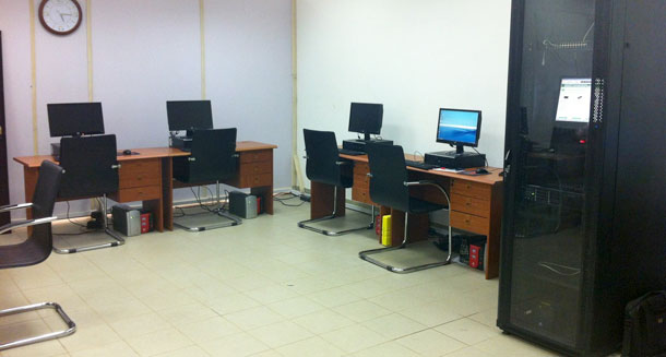
FCDA Offices
As was mentioned earlier, training of the FCDA personnel succeeds input of pilot data into the system. The reason is to use existing information for the training of the staff and testing the functionalities of the system.
The system was developed and deployed by Sivan Design using the most advanced technologies and infrastructures.
Software: Microsoft .Net, Autodesk and ESRI GIS software, Microsoft SQL database etc.
Hardware and peripherals: HP workstations, HP servers, plotter and internet connection
Accessories: Air-conditioning, generator, office equipment and many more
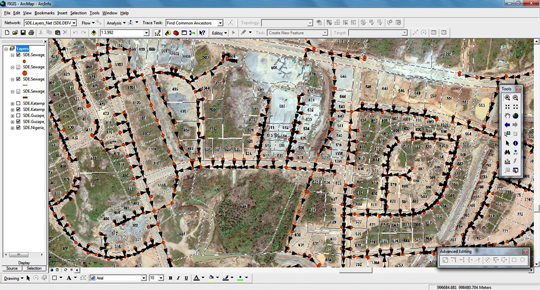
FIGIS Screen