
3D-GIS – 3D Cadastral GIS
3D-GIS in the Cloud main purpose in cadastre and urban planning tasks is to evaluate and assist in designing the use-efficiency of both existing and planned spatial space. The application provides a realistic and detailed 3D model of parcels, features and structures locates above and below ground, and ownership information. One of the biggest challenges faced by land authorities, when dealing with cadastre, is the fact that land conventional design tools are lacking the ability to handle complex, multilevel spatial spaces that are populated above and below a land parcel.
3D Cadastral GIS Features and Database
3D-GIS in the Cloud can perform different impact analysis of structures and 3D Parcels, or query either a feature or an area for its contextual GIS information. The application can store and manage 3D GIS features such as the Spatial Parcel and Spatial Sub-parcel. It can also store and manage the topological relations between the 2D parcel and the 3D Parcels and 3D Sub-parcels at the upper or under space of the 2D parcel.
The system can, for example, automatically calculate the intersecting area between a 2D Parcel and its underground overlapping 3D parcels and create a volumetric expropriation feature. Another Use case supported by the system is its capability of storing and managing common lease/common household information in a 3D environment.
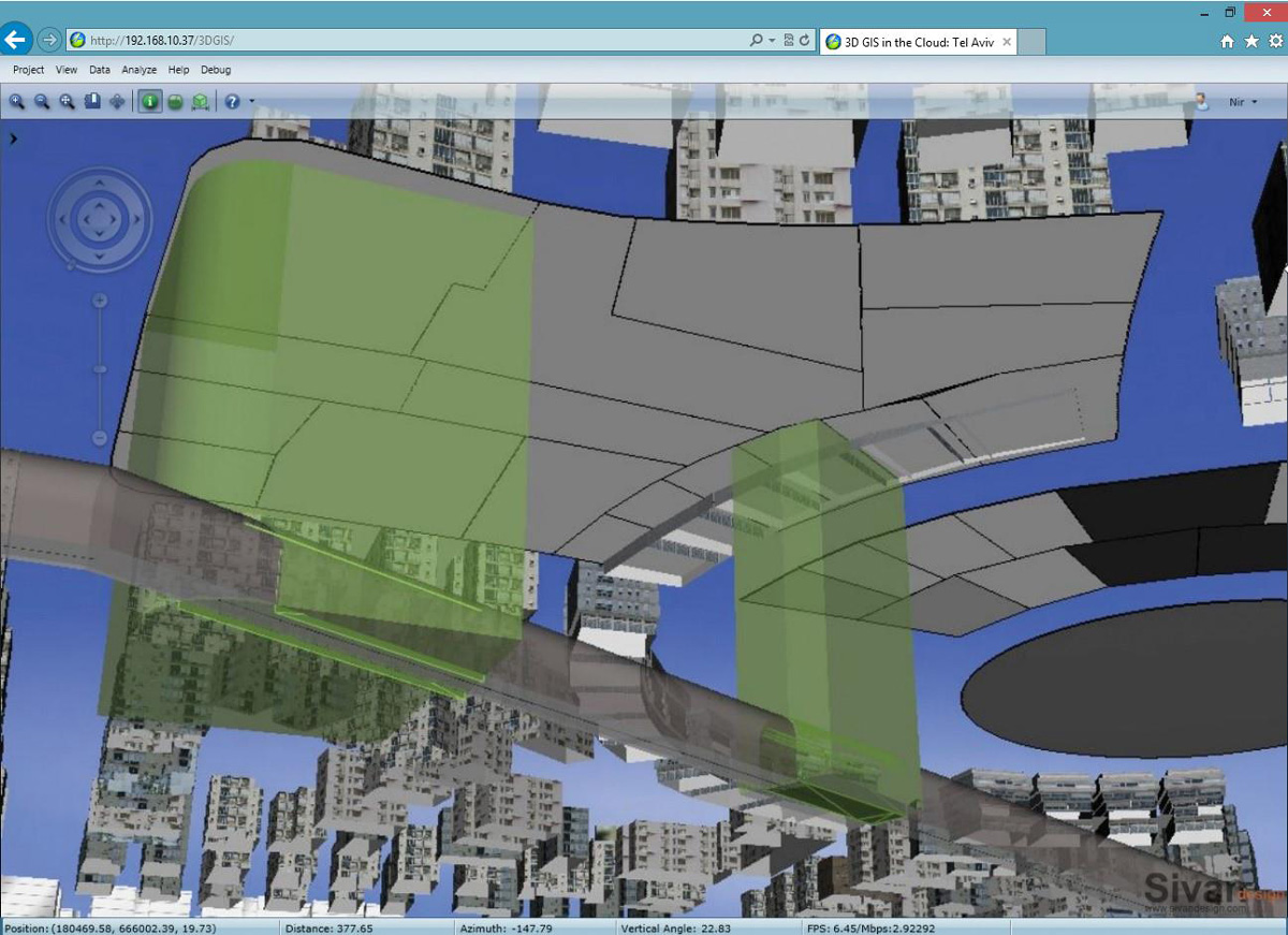
Screen shot displaying a land parcel projection on a 3D Parcel located underneath it and highlighting the intersecting volumetric area between them
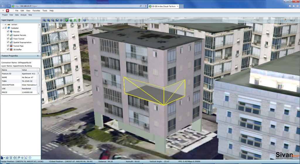
Screen shot displaying ownership information of a specific apartment
Main advantages
Regulation administration
- 3D Capabilities and Visualizations –
- Store and manage 3D Cadastral data
- Compare between existing or planned design to a specific area regulation
- Easily understand complex urban planning regulation as 3D visualization
- Web application –
- Support local governments in achieving planning consents with relevant communities
- Inform residents about new regulations in a perceivable way to facilitate an early feedback
Plans analysis and processes
- Simulate proposed plans and test-case different scenarios
- Thorough analysis of data and impacts not achievable in a 2D environment
- Time-of-day visualization and analysis of a structure’s volumetric shadow affect
- Visualize how proposed plan changes the city skyline and evaluate its impacts
- Area/Line-of-sight evaluation from various observation points and heights
- Create realistic 3D flythrough animations of any scenario such as touring within a proposed project or to evaluate situational impacts
- Evaluate expropriation of underground sub-parcels
Recently, Sivan Design has been awarded with a contract to provide The Survey of Israel with a 3D GIS in the Cloud solution to handle the country’s 3D cadatre requirements. The 3D GIS in the Cloud will co-exist alongside the governmental National Geo-Portal and information will be taken directly from there and displayed in 3D using the 3D GIS in the Cloud application.