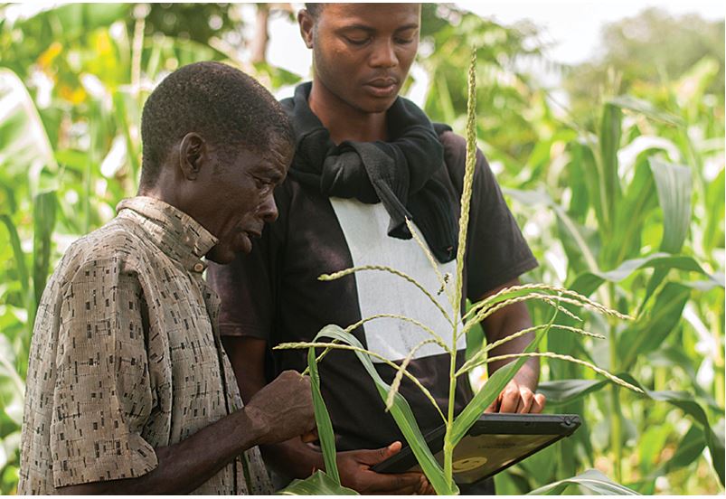
SLR Collector
The SLR collector is a tool that supports the full automation of the data collection in the field including collection of parcels boundaries and Claimants (Owners) information. It’s used by surveyors and adjudication committees as part of national land project.
The SLR collector is especially suitable for use in field conditions, resistant to falls, waterproof and allows reading in the sun.
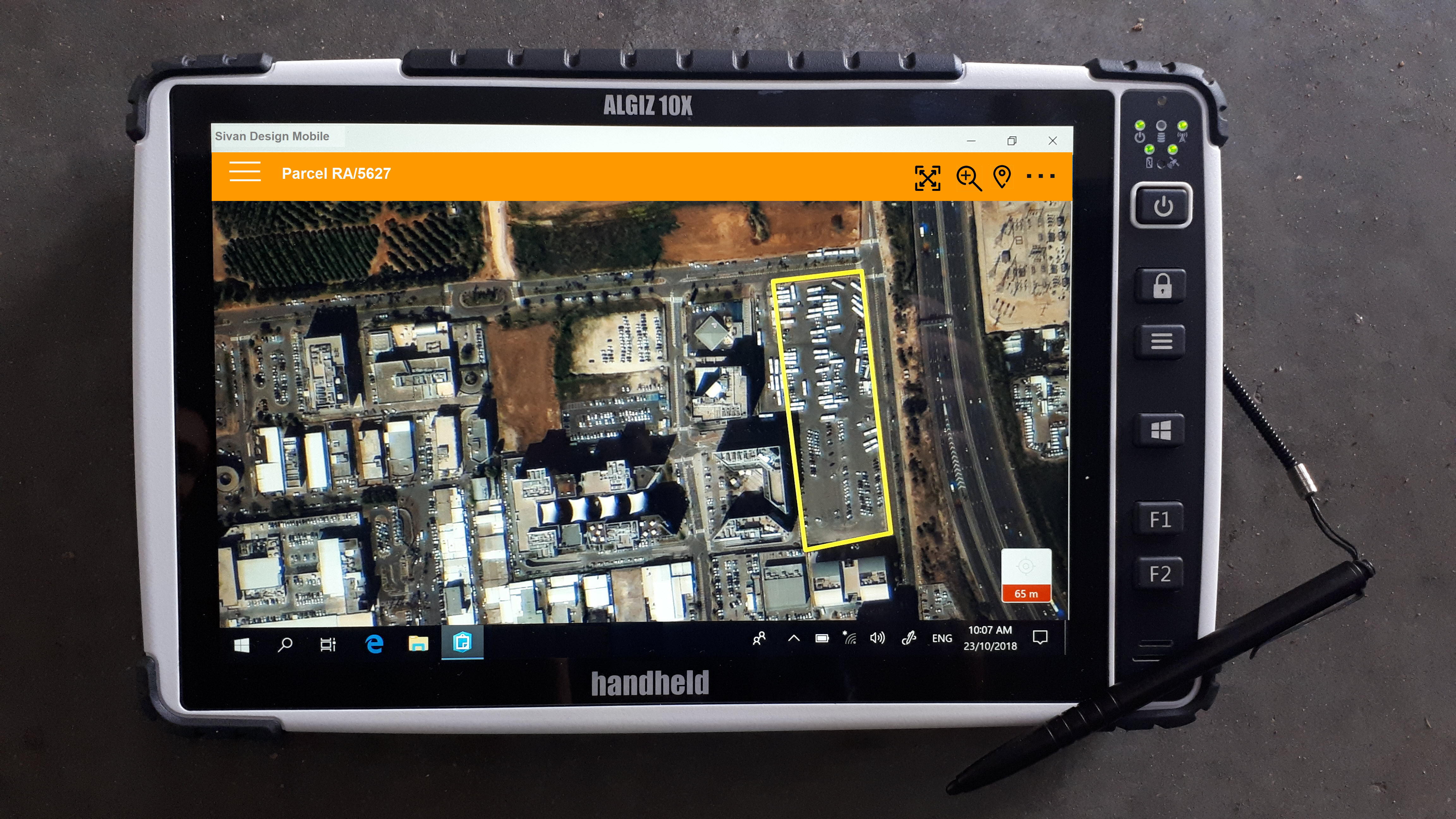
SLR Collector in the Demarcation Process
With Sivan Design’s advanced technology, the SLR collector makes the demarcation process intuitive and easy:
- Ability to perform the demarcations either by identifying the boundaries on the digital map (with a software uses GIS technology installed) and/or using the internal GPS.
- The GIS is easy to use and allows easy boundary demarcation and/or boundary correction.
- The SLR collector enables to perform the demarcation process off-line (without network coverage or WIFI).
- Automatic migration of the parcel boundaries into a central geo-spatial database and data storage in a temporary cadastral layer.
- The parcel polygon feature automatically indexed with the surveyors (the surveyor who did the demarcation) details for later identification purposes.
Field-to-office and Integration with LIS (Land Information Systems)
Our proposed solution includes the provision of the back office server which interlinks with the field mobile devices and centralises their data. The server can be installed in the client’s premises. The back office server is connected to the internet and support the following functionality –
- Field users can upload their collected data to the server at any time. This can be through the internet, in on-line / off-line modes, or direct link. The data is populated in the server in a centralised geo-spatial database, in designated GIS layer/layers.
- Important –The field user can click the “Sync” button at any time. The data is then uploaded to the server automatically at the background.
- The server can be populated with base-maps (Ortho-rectified aerial or satellite imageries). Field users can then automatically download their AOI (Area of interest) into their mobile devices, so it can serve them in their demarcation/field data collection process.
As part of our services, we can offer the client a full integration between the data collection technology and its Land Information System. Our team will interlink the back office server with the LIS – the back office server will be a “Staging server”, and the client, after verifying that the collected data is OK, can automatically migrate the data from the staging server to the LIS “production server”.
Improving accuracy by using an external Antenna
Our solution can link to an external Antenna such as the Catalyst DA1 (Trimble) and then reach GNSS accuracy of centimetres. The solution is therefore perfect for most if plots demarcation scenarios – users can do the field demarcations on the tablets by identifying plots borders using the base maps. In cases where the border point (beacon) cannot be identified (due to coverage of vegetation, problems with identifying the real location, lack of good maps coverage, etc.), users can use the external Antenna accuracy for getting the coordinates.