GeoERP is a Geographic Information System (GIS) with Enterprise Resource Planning (ERP) capabilities for land, contracts, roads and infrastructure management. The system integrates extensive GIS capabilities into the authority’s existing workflow and logics to deliver perceptible process improvements and real value gained from the GIS. The system provides the authority with management capabilities to increase taxation revenues and offers reliable revenue forecast resulting in accurate budgeting capabilities.
GeoERP offers easy customization to about any aspect of the software and seamless integration between its components. The system delivers outstanding flexibility and performance wrapped in an intuitive and user friendly interface.
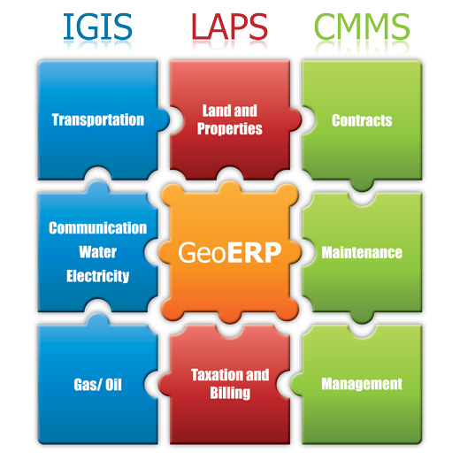
GeoERP Solutions
- LAPS – Land and Property System.
- CMMS – Contracts Management and Maintenance System.
- IGIS – Infrastructures (water systems, sewage, gas/cables, electricity) Geographic Information System.
Key features:
- All data items are correlated and accessible through a unique quick navigation interface.
- A powerful built-in GIS engine, sharing the same quick navigation principal.
- Simple windows-based application running over the internet or in a Local Area Network.
- Two user levels for the GIS environment – Expert level (local user) and web-based user.
- Modifiable Meta-data – all menus, data objects, data fields & tabs are dynamically loaded from the database, enabling complete flexibility in modifying the application.
- Data sharing with related software through XML messaging.
- Multi user control through a special short messaging technology, linking users to the database, enabling sites and field offices to share the same database.
- Storage capacity for millions of records.